Google has expanded its mapping platform to launch a new project called Timelapse, taking you back through time to see how our planet has changed over the last 25 years. To create its new interactive HTML5 animations, Google teamed up with the US Geological Survey (USGS), NASA, and TIME to combine over 2 million images taken by Landsat satellites — which are part of the longest-running Earth-observing satellite program ever.
Google’s Timelapse project shows how the Earth has changed over a quarter of a century

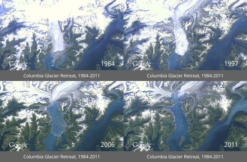
Google says it trawled through 909 terabytes of data to find the clearest images of Earth taken every year between 1984 and 2012. Compiling the shots into 1.78 terapixel images — one for each year — it worked with the CREATE Lab at Carnegie Mellon University to make them into easily viewable HTML5 animations. The project offers a number of pre-selected locations, including the creation of Dubai’s artificial Palm Islands, the melting of Alaska’s Columbia Glacier, and the the deforestation of the Amazon rainforest.
Follow topics and authors from this story to see more like this in your personalized homepage feed and to receive email updates.
Most Popular
Most Popular
- Sam Altman addresses RAM comments: People should ‘put as much as they want in their computers’
- Anker’s new window-mounted camera monitors the outside of your home from within it
- Those Jeff Bezos hair transplant photos are very fake
- The Legend of Zelda: Ocarina of Time never gets old
- Bambu’s nine-nozzle H3C foretells the future of 3D printing


